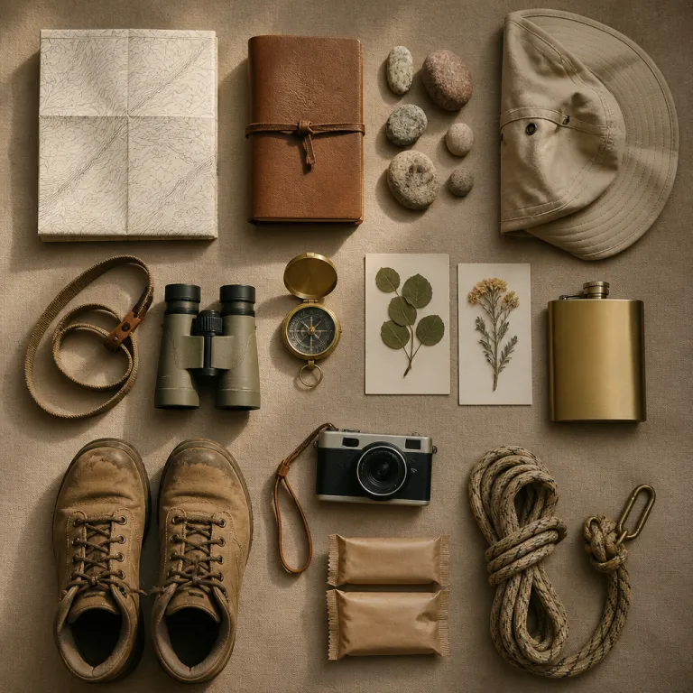
Planning a safari style itinerary around the best things to do in Big Bend
Think of Big Bend National Park as a desert safari destination shaped by river, canyon and sky. This vast protected park area in southwest Texas covers about 801,163 acres (324,219 hectares), so a thoughtful itinerary is essential for any serious wildlife and landscape enthusiast. When you plan your trip as you would a classic African safari, the main things to do in Big Bend fall naturally into morning, midday and late afternoon experiences.
Start with the geography, because the Big Bend region is defined by three distinct ecosystems. The Chihuahuan Desert, the Rio Grande river corridor and the Chisos Mountains each offer different wildlife, temperatures and scenic views, which makes them ideal for a multi day, safari inspired journey. To move efficiently between these zones, study the park map from the National Park Service and identify where each major trail, canyon and scenic drive begins, then cluster activities by road access.
For a first visit, I recommend a three to five day round trip focused on the most iconic things to do in Big Bend:
- Day 1: Ross Maxwell Scenic Drive with side canyons and overlooks.
- Day 2: Chisos Basin with a signature high elevation hike.
- Day 3: Rio Grande river corridor near Rio Grande Village and Santa Elena Canyon.
- Optional Day 4: Rafting or paddling on the Rio Grande.
- Optional Day 5: Quieter, state park style experiences in nearby protected areas outside the main national park boundary.
Time of year shapes your daily rhythm in this big desert bend. Spring brings wildflowers and milder temperatures, while summer heat pushes most hiking to dawn and dusk and makes river activities more appealing. Autumn and winter often offer clearer air, sharper views and superb stargazing, which suits photographers and wildlife watchers who prefer cooler conditions on every trail and road.
Because this is a remote national area, logistics matter as much as scenery. Fuel, water and food are limited inside Big Bend National Park, so plan resupply points before you set out on any long drive or hiking route. The nearest full service towns are Study Butte–Terlingua on the west side and Marathon on the north, with Panther Junction and Rio Grande Village providing limited fuel and basic supplies inside the park. Carry detailed maps, download mobile navigation tools in advance and always check with park rangers about current road closures, trail conditions and Rio Grande river levels before committing to a long round trip excursion.
Safety planning should mirror the discipline of a guided wilderness journey. The park service advises visitors to carry ample water, wear appropriate footwear, check weather forecasts and obtain necessary permits, and these simple rules are non negotiable in such a big and exposed landscape. Treat each day’s plan as flexible, with alternative short trails or scenic viewpoints in case heat, storms or high river flows make your original route unsafe.
Designing a multi day route along Ross Maxwell Scenic Drive and the canyons
The Ross Maxwell Scenic Drive is the backbone of many of the most rewarding things to do in Big Bend. This sinuous road runs through the western part of the park and links a series of overlooks, short trails and canyons that feel remarkably like a self guided game drive in a desert reserve. Because the Ross Maxwell route offers frequent pullouts and varied terrain, it is ideal for a full day exploration with frequent stops.
Begin early near the junction where the Ross Maxwell Scenic Drive leaves the main park road, when light is soft and wildlife is more active. As you follow this scenic corridor, pause at each signed overlook to scan for roadrunners, raptors and desert bighorn sheep on the ridges, using binoculars as you would on a savannah game drive. The Big Bend views from these stops change constantly, with each canyon and mesa catching the sun differently as the morning progresses.
Tuff Canyon is one of the first essential stops along this road. A short, relatively easy trail of about 1.7 miles (2.7 km) round trip leads into the heart of the canyon, where pale volcanic ash walls create a cool, shaded microclimate that contrasts sharply with the open desert above. The out and back walk is modest in length, but the layered rock and narrow passageways make it feel like a miniature slot canyon, especially when you explore the side channels slowly.
Further along the Ross Maxwell route, the landscape opens toward the Rio Grande corridor. Here, the road drops gradually toward the river, and the views widen to include distant Mexican sierras and the sinuous line of the Rio Grande itself. This section of the scenic drive is particularly beautiful in late afternoon, when low light emphasises the folds of each canyon wall and the big sky above the Big Bend horizon glows with colour.
Santa Elena Canyon marks the dramatic finale of the Ross Maxwell Scenic Drive. The short Santa Elena Canyon trail leads from the parking area down to the Rio Grande, then climbs a series of switchbacks to a ledge with superb canyon views in both directions. At roughly 1.7 miles (2.7 km) round trip with about 610 feet (185 m) of elevation gain, it suits most reasonably fit visitors, but allow time to sit quietly by the water and watch swallows, herons and, occasionally, turtles moving through this narrow gorge.
To structure a refined multi day itinerary, pair this Ross Maxwell day with a separate high country day in the Chisos Basin and a river focused day near Rio Grande Village. Travellers who enjoy elegant, compact itineraries may appreciate how this mirrors a three day Kruger safari plan, such as those outlined in this guide to planning a three day safari from Johannesburg. In both cases, the art lies in balancing scenic drives, short interpretive walks and one or two signature hikes, rather than trying to cover every road and trail in a single rushed trip.
Hiking the Chisos Mountains: from Lost Mine Trail to Emory Peak and the South Rim
The Chisos Mountains rise abruptly from the desert floor and form the only mountain range entirely enclosed within a United States national park. For many hikers, the most memorable things to do in Big Bend unfold on the network of trails that radiate from the Chisos Basin, where cooler air and forested slopes offer a welcome contrast to the arid lowlands. Treat this high country as you would a prime wildlife zone on safari, with early starts, careful pacing and long pauses at key viewpoints.
Lost Mine Trail is the classic introduction to the Chisos Mountains. This well graded path climbs steadily from the road above the Chisos Basin for about 4.8 miles (7.7 km) round trip, gaining roughly 1,100 feet (335 m) of elevation and revealing sweeping views over the desert and the Sierra del Carmen in Mexico. Because the Lost Mine route traverses mixed woodland and open ridges, it offers varied birdlife, changing light and multiple rest spots, which makes it ideal for travellers building fitness for longer hikes later in their trip.
For experienced hikers, the South Rim and Emory Peak form the high point of a Big Bend itinerary. The South Rim loop from the Chisos Basin can exceed 12–14.5 miles (19–23 km) round trip depending on the variant, with sustained elevation gain of 2,000–2,500 feet (610–760 m) and long stretches above 6,500 feet (1,980 m), so it demands an early start and strong legs. Emory Peak, the highest summit in the park at 7,825 feet (2,385 m), adds a steep side trip of about 10.5 miles (16.9 km) round trip in total, with a short scramble at the top rewarding those who make the effort with some of the most expansive views in the entire Big Bend region.
Because these Chisos routes are long and remote, treat them with the same respect you would give to a full day walking safari. Carry at least 3–4 litres (3–4 quarts) of water per person, sun protection, layers for changing mountain weather and a detailed map or GPS track for each trail. Check with park rangers in the Chisos Basin visitor centre about recent bear and mountain lion activity, as well as any temporary closures affecting the South Rim or Emory Peak approaches.
Those who prefer shorter outings still have plenty of rewarding options in the Chisos area. Several modest trails radiate from the basin, offering one to three hour walks with excellent views toward the Window and the desert beyond, without the commitment of a long round trip expedition. Pair one of these gentler hikes with an afternoon of birdwatching around the Chisos Basin campground or lodge area, where feeders and vegetation attract hummingbirds, jays and other species.
If you enjoy curating elegant, experience rich itineraries, you may find inspiration in this guide to refined activities in San Pedro, Belize. The same principles apply in Big Bend National Park: focus on a few exceptional trails such as Lost Mine, the South Rim or Emory Peak, allow generous time for photography and wildlife watching, and weave in restful interludes in the Chisos Basin between more demanding hikes.
Exploring the Rio Grande corridor: river trips, canyons and Grande Village
The Rio Grande river shapes the southern boundary of Big Bend National Park and gives the region much of its character. Along this international border, the river has carved deep canyons, nourished riparian oases and created a ribbon of green that contrasts dramatically with the surrounding desert. For travellers used to African or Asian river safaris, a day or two along the Rio Grande corridor offers a familiar yet distinctly Texan rhythm of water based exploration.
Santa Elena Canyon is the most famous of these river gorges, where sheer limestone walls rise more than 1,500 feet (about 460 m) above the Rio Grande. The short Santa Elena Canyon trail from the parking area offers an accessible way to experience this grandeur on foot, but the most immersive perspective comes from the water on a guided raft or canoe trip. Local operators such as Far Flung Outdoor Center organise seasonal river journeys that range from half day floats to multi day expeditions, allowing you to tailor the length and difficulty of your round trip on the river.
Further east, the Rio Grande Village area provides a different kind of river experience. Here, the floodplain widens, creating wetlands and cottonwood groves that attract migratory birds and other wildlife, especially at dawn and dusk. A short nature trail near the Rio Grande Village campground leads to a low hill with panoramic views over the river, the Mexican village of Boquillas del Carmen and the surrounding desert, making it a fine spot for sunset photography.
Boquillas Canyon offers another impressive river gorge experience. Accessed from the eastern side of the park, this canyon features a mellow trail of about 1.4 miles (2.3 km) round trip along the Rio Grande, with opportunities to watch swallows, kingfishers and, occasionally, beavers in the quieter pools. The combination of soft sand, echoing canyon walls and the steady flow of the river creates a tranquil atmosphere that contrasts with the more dramatic Santa Elena section.
When planning river based things to do in Big Bend, remember that rafting is not always possible year round. As the National Park Service notes, "Rafting is seasonal; check with local operators." Water levels, weather and border regulations can all affect what is feasible on a given day, so build flexibility into your itinerary and consult both park rangers and outfitters before committing to a specific river trip.
For travellers who enjoy walking safaris in Africa, the river corridor in Big Bend offers a chance to apply similar skills in a new environment. Quiet movement along the bank, attention to tracks in the sand and patient observation at waterholes all translate well from savannah to desert river, and you can deepen this approach by reading about how walking safaris change your perspective when you leave the vehicle. Combine a half day river trip with an unhurried afternoon around Rio Grande Village, and you will have experienced one of the most distinctive facets of Big Bend National Park.
Short scenic walks and viewpoints for a flexible Big Bend safari day
Not every day in Big Bend needs to involve a demanding ascent to the South Rim or Emory Peak. Some of the most satisfying things to do in Big Bend are short, flexible walks and roadside viewpoints that you can weave between longer drives, much as you might intersperse brief bush walks with vehicle based game viewing on safari. These options are especially valuable on hot days, travel days or when you are adjusting your plan around weather or energy levels.
Along the main park road and the Ross Maxwell Scenic Drive, numerous signed pullouts offer immediate access to big views with minimal effort. These stops often feature short paths to canyon rims, desert overlooks or river viewpoints, where you can stretch your legs and scan for wildlife without committing to a long trail. Because the light and atmosphere change throughout the day, revisiting a favourite overlook at different times can yield very different photographic results.
Tuff Canyon, mentioned earlier, is an excellent example of a short but rewarding walk. The main trail into the canyon is only about 1.7 miles (2.7 km) round trip, yet the sculpted walls and shaded floor create a sense of immersion that belies the modest distance. Similar short trails near the Window View area in the Chisos Basin or around the Rio Grande Village wetlands allow you to experience distinct habitats without the logistical demands of a full day hike.
For families or multi generational groups, these brief excursions can form the backbone of a gentle safari style itinerary. Combine a morning scenic drive with two or three short walks, a shaded picnic and an evening viewpoint, and you will have a full, varied day without overexertion. This approach also suits photographers who prefer to linger at a single bend in the river or a particular canyon rim, waiting for the right light rather than rushing to tick off every named trail.
As you plan these lighter days, pay attention to how each road and trail connects across the park area. A loop that links the Ross Maxwell route, a detour to Tuff Canyon, a pause at a Rio Grande overlook and a return via the main park road can feel like a well structured round trip, even if no single segment exceeds a few kilometres. The key is to balance driving time, walking time and unstructured pauses, just as you would when planning a relaxed day in a private reserve.
Remember that even short walks in this big desert bend demand respect for the environment. Carry water, wear sturdy footwear and keep an eye on the sky for building storms, especially during the late summer monsoon period. By treating every outing, however brief, with the same care you would give to a guided bush walk, you maintain both safety and a sense of occasion in your Big Bend National Park experience.
Practical safari style logistics: permits, safety and expert guidance in Big Bend
Behind every seamless safari or wilderness journey lies meticulous logistical planning, and Big Bend is no exception. The remoteness of this national park, combined with its extreme temperatures and limited services, means that practical details can make or break your experience. Treat your preparation as seriously as you would for a multi day expedition in a private reserve or a remote African conservancy.
Begin with access and permits, checking the National Park Service website for current entrance fees, camping regulations and any special requirements for river trips or backcountry camping. Some popular areas, such as the Chisos Basin campgrounds or certain backcountry sites near the Rio Grande, may require advance reservations, especially during peak seasons. If you plan to hike long routes like the South Rim, Emory Peak or the full Lost Mine Trail, familiarise yourself with trailhead parking rules and any restrictions on overnight parking along the main park road.
Safety planning should address heat, hydration and navigation as top priorities. Daytime temperatures in the lower desert can exceed 100 °F (38 °C) in summer, making early starts and long midday breaks essential for any serious hiking. Carrying paper maps, downloaded mobile maps and a basic first aid kit for every trail, even short ones near the Ross Maxwell Scenic Drive or Rio Grande Village, ensures you are prepared if weather or fatigue forces a change of plan.
Wildlife awareness in Big Bend differs from classic African safari destinations but still deserves respect. Black bears and mountain lions inhabit the Chisos Mountains, while rattlesnakes, scorpions and javelinas occur throughout the park area, so learn and follow park guidelines for food storage, campsite behaviour and wildlife encounters. Simple habits such as maintaining clean camps, keeping a safe distance from animals and avoiding hiking alone at dusk or after dark reduce risk significantly on any trail.
Guided experiences can add depth and safety to your itinerary, especially on the river. Local tour operators, including Far Flung Outdoor Center, offer guided rafting and hiking tours that combine expert interpretation with logistical support, which is particularly valuable for first time visitors planning complex round trip routes. As the National Park Service notes in its visitor information, "Lost Mine Trail and South Rim Trail are popular," and joining a ranger led walk on one of these routes can enrich your understanding of geology, ecology and park history.
Finally, remember that Big Bend is part of a broader regional network of protected lands, including nearby state park areas that offer additional hiking, river access and scenic drives. Integrating one of these neighbouring reserves into your trip can create a more varied, safari like journey, with contrasting landscapes and different wildlife communities. Whether you focus solely on Big Bend National Park or combine it with adjacent state park terrain, the same principles apply: plan carefully, move thoughtfully and give each canyon, trail and river bend the time it deserves.
Key figures and conservation context for Big Bend National Park
- Big Bend National Park covers approximately 801,163 acres (324,219 hectares), making it one of the largest national park units in the United States, and this vast area allows for extensive habitat diversity from desert floor to Chisos Mountains summits (National Park Service, data current to 2024; see the official Big Bend National Park statistics page on nps.gov for detailed figures).
- The park receives around 400,000–450,000 visitors per year, a relatively modest figure compared with more famous parks, which means that many trails, scenic drives and river corridors still offer a sense of solitude that safari travellers particularly value (National Park Service, 5 year average to 2023; visitation data are published on the NPS Visitor Use Statistics portal).
- Elevations in Big Bend range from about 1,800 feet (550 m) along the Rio Grande to 7,825 feet (2,385 m) at Emory Peak, creating sharp climatic gradients that influence which wildlife species and plant communities you encounter on each trail and road.
- Hiking, rafting, camping and stargazing are identified by park managers as core activities, and the growing use of mobile navigation tools is helping visitors explore safely while still supporting conservation goals such as habitat protection and minimal impact travel.
- Spring, autumn and winter are generally considered the most comfortable seasons for active pursuits, while summer heat requires careful timing of hikes and greater emphasis on river based activities along the Rio Grande corridor.
Frequently asked questions about things to do in Big Bend
What are the best hiking trails in Big Bend for a first visit ?
For a first time visitor, Lost Mine Trail and the South Rim Trail in the Chisos Mountains are widely regarded as the most rewarding hikes, offering a balance of challenge, scenery and wildlife viewing. The Window View and shorter nature trails in the Chisos Basin and Rio Grande Village areas provide gentler options with excellent views. Always check current conditions with park rangers before setting out, as weather and maintenance can affect trail accessibility.
Is rafting on the Rio Grande available throughout the year ?
Rafting on the Rio Grande in Big Bend is not consistently available all year, because river levels depend on rainfall, upstream water management and seasonal patterns. As the official guidance states, "Rafting is seasonal; check with local operators." Before planning a river trip, contact outfitters such as Far Flung Outdoor Center and consult the National Park Service for up to date information on flows, access points and permit requirements.
Are there guided tours and ranger led activities in Big Bend National Park ?
Yes, Big Bend National Park offers ranger led walks, talks and evening programs during many parts of the year, focusing on topics such as geology, desert ecology and night skies. In addition, private tour operators provide guided hiking, rafting and driving experiences that can be tailored to your interests and fitness level. These guided options are particularly valuable for travellers who are new to desert environments or who prefer a safari style experience with expert interpretation.
How many days should I plan for Big Bend if I enjoy safari style travel ?
Travellers who appreciate safari style itineraries typically allocate at least three to five days for Big Bend National Park. This allows one day for the Ross Maxwell Scenic Drive and Santa Elena Canyon, one for the Chisos Basin and a signature hike such as Lost Mine, and one for the Rio Grande Village area and a river based activity. With additional days, you can add longer routes such as the South Rim or Emory Peak and explore quieter corners of the park area at a more relaxed pace.
What essential safety tips should I follow while hiking and driving in Big Bend ?
Key safety practices include carrying ample water, wearing sturdy footwear, checking weather forecasts and obtaining any necessary permits before backcountry travel. Start strenuous hikes early to avoid midday heat, let someone know your planned route and expected return time, and be prepared to turn back if conditions deteriorate. On scenic drives and remote roads, ensure your vehicle is in good condition, carry a spare tyre and tools, and keep extra water and food in case of delays or breakdowns.