Reading a victoria falls map for your first safari journey
A well interpreted victoria falls map turns a simple visit into a structured safari experience. When you understand how the falls relate to each gorge, each national park, and each access road, you move with confidence instead of guesswork. This clarity matters even more when you are planning cross border travel between Zambia, Zimbabwe, and wider southern Africa.
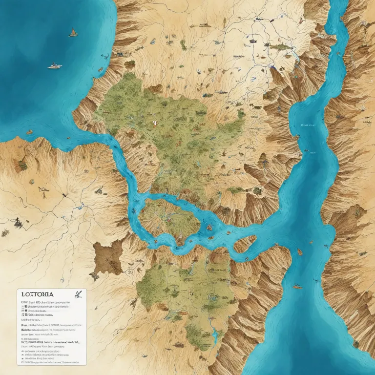
On any detailed map, start with the broad frame of Africa, then narrow down to the southern region where the Zambezi River forms the natural boundary between Zambia and Zimbabwe. You will see the river widening before it suddenly plunges into the great chasm known as the Batoka Gorge, which is the dramatic setting for Victoria Falls itself. From there, the map will show how the river Zambezí twists through a series of zigzagging gorges that shape both the landscape and the adventure activities.
Next, identify the twin gateway towns that anchor every visit to Victoria Falls. On the Zambian side, Livingstone in southern Zambia sits slightly upstream, linked by road to Mosi oa Tunya National Park and the main viewpoints above the falls. On the Zimbabwean side, the town of Victoria Falls lies beside Victoria Falls National Park, where a network of paths offers classic frontal views of the falls from multiple angles.
As you compare these locations on your chosen map, note the position of the famous Falls Bridge that connects Zambia and Zimbabwe directly above the Batoka Gorge. This bridge is not only a border crossing but also a landmark for bungee jumping, photography, and panoramic views of the Zambezi River. Understanding how the bridge, the towns, and each national park align will shape every decision you make on safari.
Tracing the river and gorges from aerial views to footpaths
When you zoom in on a high resolution victoria falls map, the first feature that dominates the image is the Zambezi River spreading wide before it suddenly drops into the narrow trench of the main falls. From the air, or on a satellite based Google Map, you can clearly see how the river channels into a single curtain of water more than 1 700 metres wide. This immense sheet then explodes into mist as it crashes into the Batoka Gorge, carving a deep, twisting canyon that continues downstream.
The gorge system is central to understanding both the geology and the adventure opportunities around Victoria Falls. Each segment of the gorge offers different white water rafting grades, viewpoints, and hiking routes, which are all easier to plan when you can read their positions on a map. If you are comparing remote wilderness experiences, it can be helpful to contrast this river gorge environment with polar landscapes described in an Antarctica cruise news and wildlife expeditions guide.
On the Zambian side of the river, the map will highlight Mosi oa Tunya National Park, a compact reserve that protects both the rainforest around the falls and a stretch of savanna where you can join short safari drives. The park’s boundaries follow the river closely, so you can easily see how game drive routes parallel the water. On the Zimbabwean side, Victoria Falls National Park and the adjacent Zambezi National Park extend along the riverbank, creating a longer corridor of protected land.
By studying how these national parks hug the Zambezi River and its gorges, you gain a realistic sense of distances and travel times. This helps you decide whether to focus on the Zambian side, the Zimbabwean side, or to split your stay between both. It also clarifies how far you must go from the main falls to reach quieter stretches of river for canoeing, birding, or sunset cruises.
Comparing Zambian and Zimbabwean sides for wildlife and viewpoints
A thoughtful victoria falls map does more than show where the water drops ; it reveals how different the Zambian side and the Zimbabwean side feel on the ground. On the Zambian side, the town of Livingstone Zambia sits a short drive from the entrance to Mosi oa Tunya National Park, where trails lead to cliff edge viewpoints and seasonal access to the famous rock pools. These paths hug the lip of the falls, giving you intimate views into the gorge and across the river to Zimbabwe.
On the Zimbabwean side, the town of Victoria Falls lies almost within walking distance of Victoria Falls National Park, which offers a long chain of viewpoints facing the main curtain of water. A good map will mark each viewpoint, showing how the path curves through rainforest created by the constant spray. Because this side faces more of the falls directly, many travelers consider it the best place for classic panoramic photographs and extended viewing sessions.
Wildlife experiences also differ between the two countries, and a map helps you visualise these contrasts. Mosi oa Tunya National Park is small but accessible, ideal for short game drives that fit between river activities and falls visits. In contrast, the larger Zambezi National Park stretches upstream from the town of Victoria Falls, offering more extensive safari routes along the river Zambezí and deeper into the bush.
When planning a broader safari circuit, compare these parks with other renowned reserves using resources such as an overview of unforgettable national parks to visit in April. This helps you balance time between river based activities, gorge viewpoints, and traditional game drives. With a clear map, you can design an itinerary that respects travel times while still sampling both the Zambian and Zimbabwean perspectives on the falls.
Planning cross border travel between Zambia, Zimbabwe, and beyond
Because Victoria Falls straddles the border between Zambia and Zimbabwe, a precise victoria falls map is essential for cross border planning. The map will show how the Falls Bridge links the Zambian side near Mosi oa Tunya National Park with the Zimbabwean side near Victoria Falls National Park, making it the key crossing point for most visitors. Understanding this layout helps you schedule transfers, manage visa requirements, and avoid unnecessary backtracking.
Many travelers arrive via Livingstone in Zambia or via the town of Victoria Falls in Zimbabwe, then use the bridge to move between the two countries. On the map, you can trace the short but important road sections from each town to the border posts, noting how close they are to the main viewpoints and river access points. This visual overview is particularly useful if you plan to use a multi country visa that allows movement between Zambia, Zimbabwe, and sometimes neighbouring Botswana.
From a wider regional perspective, the map also situates Victoria Falls within southern Africa’s safari network. To the south, road links lead toward Botswana and its famous wetlands, while flights connect to major hubs in South Africa for onward travel. By overlaying flight routes and road corridors on your map, you can see how easily a visit to the falls combines with longer safaris or coastal extensions.
When you compare distances and connections, consider how much time you want to spend at the river and in the surrounding national parks. A carefully read map allows you to integrate Victoria Falls into a broader safari journey without rushing key experiences. This is especially important if you are coordinating multiple border crossings, river activities, and game drives within a limited schedule.
Using maps to match activities with seasons and water levels
Seasonal changes at Victoria Falls are dramatic, and a detailed victoria falls map helps you align activities with water levels. During the wettest months, the Zambezi River swells and the falls unleash their full power, sending spray high above the gorge and drenching nearby viewpoints. At this time, some paths on both the Zambian side and the Zimbabwean side can be slippery, so it is helpful to know which trails and viewing platforms are closest to your lodge or camp.
On a good map, you can mark which viewpoints offer the strongest frontal views when the water is high and which ones remain clear when the mist is thick. You can also see where alternative activities such as helicopter flights, microlight trips, or river cruises depart along the riverbank. This allows you to plan days that balance intense spray filled viewing with calmer experiences on the upper river or within nearby national parks.
As water levels drop, new opportunities appear along the lip of the falls and within the gorge. Certain rock pools on the Zambian side become accessible with licensed guides, and white water rafting in the Batoka Gorge becomes more technical and extended. By plotting these seasonal activity zones on your map, you can decide whether to focus on high volume spectacle, adventure sports, or a mix of both.
For travelers building complex safari itineraries, it can be useful to compare this seasonal planning with other destinations, such as timing an elephant safari in a distant national park. In every case, the principle is the same ; use maps to match your expectations with the realities of river flow, park access, and wildlife behaviour. This approach leads to more rewarding experiences and fewer logistical surprises.
Interpreting cultural history and conservation through the map
A nuanced victoria falls map can also serve as a guide to cultural history and conservation priorities. Long before the arrival of European explorers, the Kalolo Lozi people named the falls “Mosi oa Tunya,” meaning “The Smoke That Thunders,” and this name now lives on in Mosi oa Tunya National Park. When you see this park labelled on the Zambian side of the river, you are looking at a living link between indigenous heritage and modern conservation.
The map also reflects the legacy of David Livingstone, the first recorded European to see the falls, who later named them after Queen Victoria. His journeys along the Zambezi River are often marked by plaques and viewpoints near the edge of the gorge, and some maps highlight these historical sites. By tracing his route on a modern map, you can appreciate how challenging it was to reach this remote section of river in the past.
Conservation areas on both sides of the border are clearly delineated on official maps, showing how national parks protect the rainforest, riverbanks, and surrounding savanna. These boundaries are not arbitrary ; they are designed to safeguard biodiversity while still allowing sustainable tourism. When you see how Mosi oa Tunya National Park and Victoria Falls National Park connect with other protected zones, you gain insight into regional wildlife corridors.
Modern maps may also indicate hydroelectric projects, community areas, and tourism concessions along the river Zambezí and within the Batoka Gorge. Understanding where these developments sit in relation to the main falls helps you evaluate the balance between economic needs and environmental protection. In this way, a simple map becomes a tool for reading the ongoing story of people, wildlife, and water at one of Africa’s most iconic landscapes.
Practical tips for choosing and using your victoria falls map
To make the most of your trip, choose a victoria falls map that combines topographic detail with clear labels for towns, parks, and river features. Look for editions that show contour lines around the Batoka Gorge, as these reveal how steep the cliffs are and where paths descend toward the river. Maps that include both the Zambian side and the Zimbabwean side on a single sheet are especially useful for cross border planning.
Digital tools such as Google Map are excellent for checking distances between Livingstone, the town of Victoria Falls, and nearby national parks. However, mobile coverage can be patchy near the gorge, so it is wise to carry an offline map or printed copy as backup. When you mark your planned viewpoints, river cruises, and game drives on both digital and paper maps, you reduce the risk of missed connections or rushed transfers.
Before you travel, spend time familiarising yourself with the layout of the Zambezi River, the position of the Falls Bridge, and the access roads to each park gate. This preparation makes it easier to communicate with guides, drivers, and border officials once you arrive. It also helps you understand safety briefings for activities such as rafting, bungee jumping, or helicopter flights over the gorge.
Finally, remember that a map is not only a navigation tool but also a way to deepen your appreciation of the landscape. As you stand at a viewpoint watching the river plunge into the chasm, you can mentally trace its journey across the plateau and through the gorges you studied earlier. This connection between paper, screen, and real world experience is what transforms a simple visit into a richly informed safari journey.
Key statistics about Victoria Falls
- Width of Victoria Falls : 1 708 metres from bank to bank.
- Height of the main waterfall : approximately 108 metres at its deepest point.
- Average flow rate of the Zambezi River at the falls : about 935 cubic metres per second.
Essential questions about visiting Victoria Falls
What is the best time to visit Victoria Falls?
The best time to visit is during the wet season, from February to May, when the falls are at their fullest.
Are there activities available at Victoria Falls?
Yes, activities include guided tours, bungee jumping, white water rafting, and helicopter flights over the falls.
Do I need a visa to visit both sides of Victoria Falls?
Yes, visitors typically need visas for both Zambia and Zimbabwe ; however, a KAZA UniVisa allows access to both countries.
